Selected Projects
DCVG Coating Surveys on Six Pipeline Segments, Carlsbad and Loving (2024-2025)
We typically respond within one business day.
Project at a glanceDE-PRJ-8117
- Practice
- Corrosion and CP
- Location
- Permian Basin, NM
- Service
- DCVG surveys
- Client
- Confidential
DCVG Coating Surveys on Six Pipeline Segments, Carlsbad and Loving (2024-2025)
In 2024 and 2025 we ran direct current voltage gradient coating surveys (DCVG surveys) on six pipeline segments near Carlsbad and Loving, New Mexico. The segments were anywhere from 1,100 to 7,000 feet long. We can’t share details about the client.
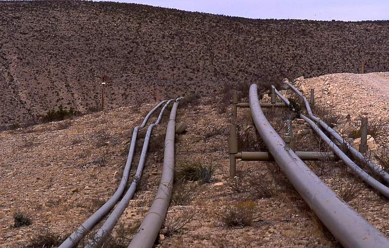
A pipeline like the ones we surveyed with DCVG. The survey finds coating defects from the surface, before anything is dug up.
Coating holidays on Permian Basin lines
Carlsbad and Loving sit over the Permian Basin, and there’s buried pipeline all through the area. On a buried line, the coating is the first barrier against external corrosion, and cathodic protection backs it up where the coating has flaws. Coatings can develop holidays over time. A holiday is a small defect where bare steel touches the soil, and a DCVG survey can find one from the surface without digging up the right of way. This job was six separate segments, some short and some much longer, so the logistics and the way we set up the reports mattered as much as the field technique.
When the segment is short
DCVG is often thought of as work for long transmission lines. On those, a crew mobilizes once and walks for miles, and the setup cost is spread over a lot of footage. Short segments don’t give you that. On a 1,100 foot segment, mobilizing, coordinating access, setting up the current interrupters and checking the equipment can add up to as much as the survey walk itself. It’s more efficient to group nearby segments into shared field days, and the Carlsbad and Loving locations made that possible here. The reporting is different too. A long-line survey usually ends up as one continuous record of indications. With several segments, each one needs a self-contained report with its own baseline data, indication list and severity ranking. That way each segment can be evaluated by itself, and its repairs budgeted and scheduled separately.
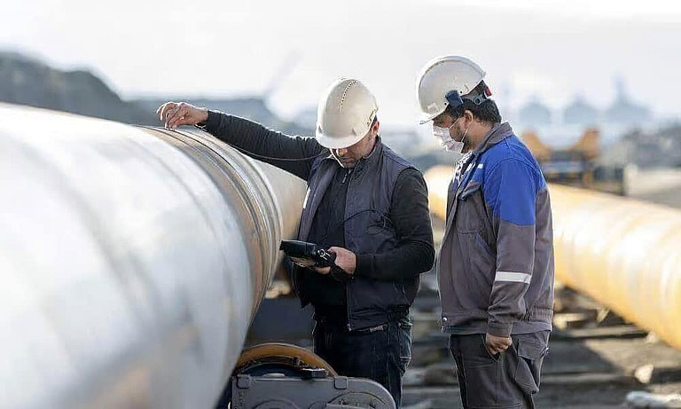
Pipe like the lines we surveyed, sitting above ground with workers next to it and more joints staged behind. After a survey, the indications are ranked by severity, and only the ones that call for it get excavated so the coating can be examined and repaired.
Turning indications into a dig list
A coating survey is an indirect inspection. Most of its value comes from what’s done with the results. The indications are ranked by severity and then checked by direct examination. Some of them get dug up, and at each dig the coating condition and any metal loss are documented, then compared with what the survey predicted. That comparison is how the survey gets calibrated. If the digs confirm the grading, the remaining indications can be prioritized with confidence. If they don’t, the survey interpretation gets a second look before anyone builds a dig program on it.
External corrosion direct assessment is set up the same way, in four stages. It starts with pre-assessment, where records, soil data and coating history show which tools apply and where. Next is indirect inspection, the surface surveys such as DCVG that locate and grade indications. Then direct examination, where selected locations are excavated and evaluated. Last, in post-assessment, the results set the reassessment interval and feed back into the integrity program. Reporting by segment fits straight into that, because each segment carries its own indication list and dig results and keeps its own schedule.
The results also say something about the protection system. When active indications cluster along one stretch, it can mean the coating is failing there, or it can mean the cathodic protection in that area isn’t keeping up. Pipe-to-soil potential data is how you tell which. Operators who want both data sets read together can start with our direct assessment services.
Surveying the six segments
On each segment, our AMPP® (NACE) certified cathodic protection personnel interrupted the current source feeding the line, then surveyed it at close intervals, measuring voltage gradients in the soil. Where cathodic protection current collects at a coating defect, it sets up a gradient at grade. The survey picks up that gradient, which lets us locate the defect and classify it by relative severity. We logged the position of every indication and compiled the results one segment at a time for all six, from the 1,100 foot line to the 7,000 foot line. Licensed Professional Engineers reviewed the data and the reports, so each report could stand on its own as a basis for repair decisions.
Pairing DCVG with potential data
DCVG answers only part of the external corrosion question. It shows where the coating has defects. Pipe-to-soil potential data shows whether the cathodic protection system is adequately protecting the steel at those spots. Run coating surveys together with cathodic protection potential surveys and you can see how the whole external corrosion control system is doing. The per-segment results also become the baseline for future integrity decisions. Our Colorado pipeline surveys project covered related fieldwork in different terrain.
Corrosion and CP
Related projects
Carlsbad, NM
DCVG Survey of New Gas and Crude Oil Lines, Carlsbad
DCVG survey
Jal, Carlsbad and Lea County, NM
DCVG Acceptance Surveys on New Crude Oil Lines, Southeast New Mexico
DCVG survey
Central Texas
DCVG Survey of a New Pipeline Spread, Central Texas
DCVG survey
More work in: New Mexico
Get your project started
We typically respond within one business day.