Selected Projects
Statewide Colorado Pipeline Surveys (2025)
We typically respond within one business day.
Project at a glanceDE-PRJ-8103
- Practice
- Corrosion and CP
- Location
- Colorado
- Service
- CP surveys
- Client
- Confidential
Statewide Colorado Pipeline Surveys (2025)
This job took our corrosion team along pipeline rights-of-way across Colorado in 2025, running direct-current voltage gradient (DCVG) and depth-of-cover surveys. The client’s details stay confidential.
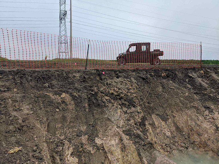
Survey work on a right of way. Coating and depth-of-cover surveys get walked or driven a segment at a time.
Survey cycles in rocky, high-resistivity ground
Colorado pipeline operators have surveys coming due on a recurring cycle, and the ground there doesn’t make the work easy. Rocky terrain and soils that often run high in resistivity make coating defects harder to detect and cathodic protection harder to get working well. On a statewide job like this one, terrain and access vary a great deal.
Finding coating holidays from the surface
A buried, coated pipeline under cathodic protection collects protective current through the soil wherever the coating is damaged. That current sets up a voltage gradient in the soil over each defect, and a DCVG survey walks the line measuring it. What you get is a map of the coating holidays, each one graded by the strength of its signal, and nobody has to dig anything up to make it. The grades matter as much as the locations. They’re how a good survey separates the defects worth excavating now from the ones worth watching, so the dig budget gets spent on the riskiest ones.
Depth of cover on the same trip
A depth-of-cover check measures how much soil there is between the pipe and the surface. That changes over the years with erosion and regrading, and with any construction along the route. Where the cover has gone shallow, a third party is more likely to hit the line, and the line may no longer match its own records. Both surveys walk the same right-of-way, so they can be done in one mobilization and the client doesn’t need a second campaign.
Ranking what the survey finds
Knowing where an indication is doesn’t tell an operator what to do about it. For that they need a severity ranking. Severity comes from comparing the gradient measured at the defect with the total pipe-to-remote-earth voltage shift at that spot, and it’s expressed as a percentage instead of a raw millivolt reading. That puts indications from different parts of the line, in different soils, on the same scale. A large gradient in high-resistivity ground and a small one in wet clay can mean about the same amount of exposed steel, and only the normalized figure shows it.
The survey can also say how a defect is behaving, which isn’t the same as how big it is. Readings are compared with the protective current on, with it interrupted, and after the line has been left to depolarize. That comparison separates defects that are collecting protective current as intended from ones that are actively discharging current, and the discharging ones are more urgent. The coating results are worth pairing with pipe-to-soil potential data over the same footage. The coating survey tells you where bare steel is exposed, and the potential data tells you whether the cathodic protection is reaching it. Our potential survey services cover that part.
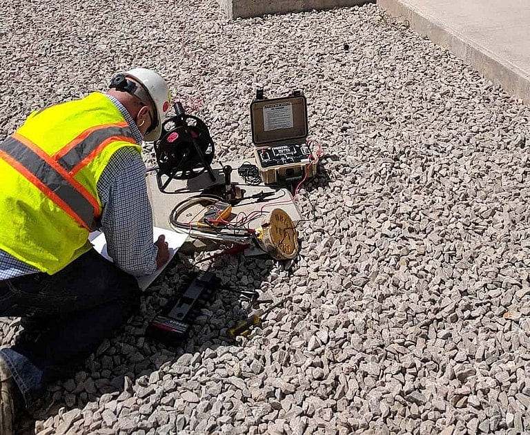
A cable reel, test leads and a handheld meter laid out at ground level. The terrain and the access decide how a crew stages this kit and how much line it covers in a day.
Planning field days across the state
Working statewide in Colorado means a crew sees several kinds of ground in a single program. Rocky, gravelly ground raises soil resistivity and makes good probe contact harder to get, which changes how big the gradients are and how far the readings over them can be trusted. Dry or frozen surface soil does the same, and both push the survey schedule toward the times of year when the ground will cooperate. Elevation changes, drainage crossings and road and rail crossings all break up the walk, and those tend to be the places where cover and coating are in the worst condition.
Then there’s access. Rights of way cross private land, public land with its own permitting, and terrain a vehicle can’t follow, so the field plan is built around who can be reached and when. Each indication should get GPS coordinates along with its chainage. The crew that comes back to excavate usually isn’t the crew that walked the line, and the coordinates are how they find the spot.
The crew and the report
The DCVG surveys were run by our AMPP® (NACE)-certified cathodic protection personnel, who located the coating anomalies and graded them. Depth of cover was verified along the same routes, and the field work was overseen by licensed Professional Engineers. We gave the client a prioritized report to work from. It showed where to dig and what to keep monitoring, and which spots could be left alone.
When your next survey comes due
Without surveys, an operator is left guessing at coating condition. If your Colorado assets are on a survey cycle, our CP survey services and Colorado team can run the whole program for you.
Our blog has more on cathodic protection in high-resistivity Rocky Mountain soils and the compliance cycles Colorado pipeline operators face.
Corrosion and CP
Related projects
Guadalupe County area, TX
Baseline CP Survey of Two Water Mains, Guadalupe County Area
CP survey, current requirement tests
Highland Lakes area, TX
CP and Ground Grid Survey at a Power Plant, Highland Lakes Area
CP survey, ground grid survey
Eastland area, TX
Annual CP Survey and Ground Patrol of a Gas Line, Eastland Area
CP survey, ground patrol
More work in: Colorado, AC Interference and Mitigation in Colorado, Colorado UST Cathodic Protection
Get your project started
We typically respond within one business day.