Consulting Areas
Pipeline Locating and Depth of Cover Surveys
We typically respond within one business day.
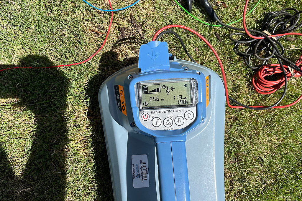
Find the line before anything else
Every cathodic protection survey, coating survey and dig starts with knowing exactly where the pipe runs. Drawings and records are often incomplete, especially on older plants and gathering systems, and PHMSA warns that pipeline markers show only the general location of a line, not its precise position or its depth. We locate buried lines with pipe and cable locators, and on longer lines with our pipeline current mapper, which traces a line and measures the signal current on it.
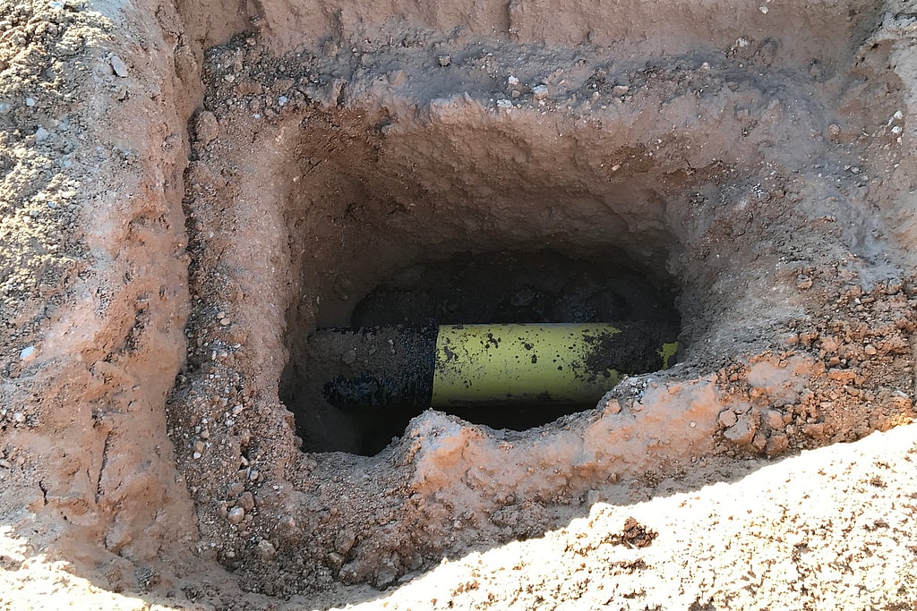
How electromagnetic locating works
A pipe locator does not detect the pipe itself. It detects the alternating magnetic field around a metal line that carries an AC signal, and finds the line from where that field peaks or nulls. Some lines already carry a signal picked up along their length, such as power frequency current or long wave radio energy, and finding those is called passive locating. For pipelines we normally locate actively, with a transmitter that puts a known signal on the line we want, so that line can be told apart from its neighbors.
There are three ways to apply that signal:
- Direct connection. The transmitter is connected to the pipe at a test lead, riser, valve or other access point, and the circuit is completed through a ground stake.
- Induction. The transmitter is set on the ground over the line and its coil induces a signal in the pipe below, with no connection needed. It is quick to set up, but the higher frequencies used for induction also couple onto other lines nearby more easily.
- Clamping. A signal clamp around an exposed pipe or cable puts the signal on that line without electrical contact.
Insulating joints block much of the signal, so a line may need a new connection on the far side, and any line that shares a ground with the target can carry some of the signal too. On longer lines, our pipeline current mapper traces the line and measures the signal current on it in the same pass. Plastic pipe carries no signal of its own; it can be traced only through a tracer wire laid with it or a small transmitter, called a sonde, pushed through it.
How the survey is done
- A signal is put on the line by direct connection at a test station or riser, or by induction where there is no connection point
- The crew walks or drives the route, marking the centerline and recording depth at set intervals and at crossings, ditches, bends and other features
- Positions are recorded with GPS so the results can be mapped against the operator’s records
- Shallow spots, exposed pipe and damage to aboveground piping are photographed and listed in the report
Because the same right-of-way is walked for other work, locating and depth of cover are often added to a DCVG coating survey or an annual CP survey. On a statewide Colorado job, DCVG and depth of cover surveys were run in one mobilization, so the client did not need a second campaign.
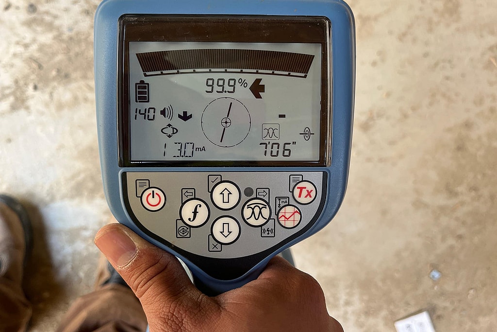
Related projects
- Fire Water Piping and Tank CP Survey at a Glass Plant, Wichita Falls
- Baseline CP Surveys at Two Power Stations, El Paso
What makes a locate harder
Most locating errors come from a distorted field rather than from the instrument. The magnetic field around a line can be bent so that its peak is no longer straight above the pipe, and then both the position and the depth reading shift. Common causes:
- Other pipes and cables running parallel or crossing close by, as in shared corridors and plant piping
- Tees, bends and abrupt changes in depth, where the field is no longer a simple cylinder around a straight line
- Vehicles, fences, aboveground piping and other large metal near the receiver
- A signal that has coupled onto the wrong line
We check for distortion as we go. The locator’s peak and null positions should agree; when they do not, the reading is moved or repeated. A depth reading can be checked by raising the receiver a known height and confirming that the depth goes up by the same amount. Where several lines run together, current direction readings show which line carries the transmitter’s signal, because signal that has leaked onto an adjacent line reads in the opposite direction. Stretches that still cannot be resolved are flagged in the report, not guessed.
Need a line found and marked before a survey or a dig? Request a free quote. We typically respond within one business day.
What locating does not replace
Our locating supports engineering surveys and the operator’s records. It does not replace the 811 one-call notice. Anyone planning to dig must call 811 so that every utility in the area can mark its lines; in Texas the call has to be made at least 48 hours before digging.
What you receive
- The centerline marked on the ground with paint, flags or stakes
- Logged positions of the route, mapped against your drawings, with differences noted
- Road, ditch and foreign line crossings, test stations, valves, casings and other features recorded and photographed
- Depth readings where they were requested; for a full survey of cover, see our depth of cover surveys
- Notes on any stretch where the line could not be traced with confidence, and why
Locating is usually the first day of a larger job. The located line is what a close interval survey, a current mapping survey or an ACVG or DCVG coating survey follows, and what an ECDA excavation plan is built on. On one annual survey of a gathering line, walking the located route also turned up pipe left exposed at a crossing.
Frequently asked questions
How are buried pipelines located?
With an electromagnetic locator. A transmitter puts a signal on the pipe by direct connection, induction or a clamp, and a receiver carried along the route finds the line from the magnetic field that the signal produces. Positions are logged with GPS and the centerline is marked.
How does a pipe locator work?
It measures the alternating magnetic field around a metal line that carries a signal. The field is strongest straight above the line, so the receiver finds the line where the reading peaks, and it estimates depth from the shape of the field. It does not see the pipe itself, which is why distorted fields need checking.
Can you locate a plastic pipe?
Only if it has a tracer wire laid with it, or an access point where a sonde, a small transmitter, can be pushed through the pipe. Plastic carries no signal for a locator to follow.
Does pipeline locating replace calling 811?
No. Anyone planning to dig must still call 811 so that every utility in the area marks its lines. Our locating supports engineering surveys and the operator’s records; it is not a one-call locate.
Talk to an engineer
Need lines found, mapped or checked for cover? Request a free quote. We typically respond within one business day.
Get your project started
We typically respond within one business day.